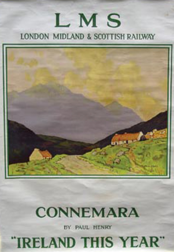
In 1925, Belfast-born artist Paul Henry painted the first travel poster to be commissioned by The London Midland and Scottish Railway Company. It was designed to entice tourists to the west of Ireland, and depicted familiar Henry themes of big mountains, big skies, small cottages, no people. This poster greeted Trekkers when they arrived in the Station House hotel, Clifden, on Thursday, April 10. The hotel would be our luxurious "base camp" for the coming three days' hikes.
Owen (McKeown) employed a lure of a different kind to entice Trekkers to Paul Henry land: The Glencoaghan Horseshoe. In an advance email, he described this hike, which takes in six of Connemara's twelve Bens, as "probably one of the finest walks in Ireland, with spectacular views in good weather." While only 13 kilometres long, the cumulative ascents amount to 1,623 meters, and average time for the walk is nine hours. "This places the walk firmly in A++ territory," Owen cautioned, "and I want all aspiring walkers to be fully aware of what they are signing up for." Forewarned, and with food, poles and water at the ready, nine Trekkers left the Station House at 8.30 am on Friday, April 11 (more of the group would join us on Saturday), headed for the Benlettery hostel, about nine miles east of Clifden and the starting point for the horseshoe, if tackling it in a clockwise direction.
The way up looked steep, but Owen assured us that it was preferable to tackle the route in a clockwise direction as the descent back towards the hostel would feel a lot steeper on tired legs at the end of a 9to10 hour hike, if doing it in an anticlockwise direction.
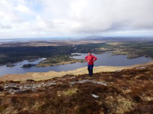
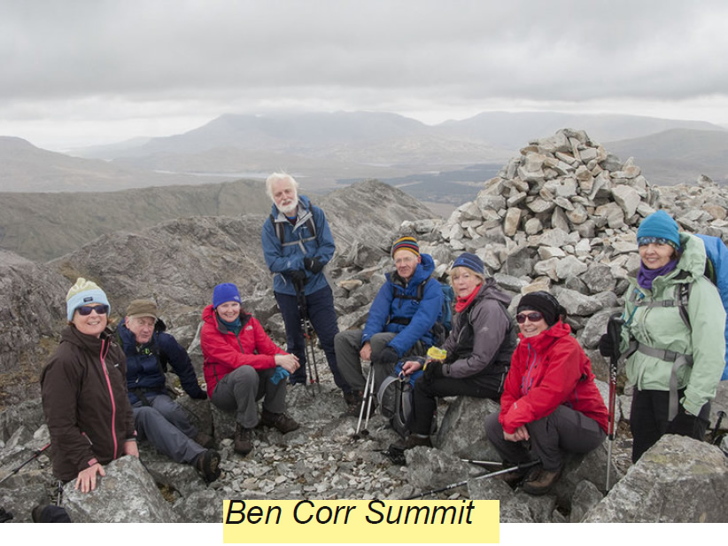
From half-way up Benlettery, the first Ben on our route, the views were already spectacular. Looking back from where we had come, you could only but be entranced by the amount of water everywhere and marvel at how anyone ever managed to put a road through this connect-the-bits-of-land landscape. Pockets of land were interrupted by parcels of water, some tiny, others big enough to warrant a boat of two. In the distance, the islands of Galway Bay and Clew Bay rose to dominate the views towards the western horizon. And, upwards, the summit still hadn't revealed itself, but it would in due course. Some time and increasingly panoramic vistas later, Benlettery at 577 meters (the ascent is more or less from sea level) was bagged. From there, a pattern set in that continued for the rest of the day, steep descents, most on loose slippy scree, followed by steep ascents, with Ben Breen (Ben no. 3 on our route) and Benn Corr (Ben no. 5) being particularly steep. Throughout, the terrain was rocky, rocky, rocky. Big rocks, small rocks, all uneven, and causing you to be attentive of every step.
A compliment from the leader
The most exciting time in the hike came after Ben no. 2, Ben Gabhar. Owen had warned us about this section, and he came prepared: "The descent from Ben Gabhar to Maumnageeragh (a saddle point between Ben Gabhar and Ben Breen) is steep and, in places, involves some scrambling. This might cause difficulties for some people and I will carry a rope to help with confidence, where necessary."
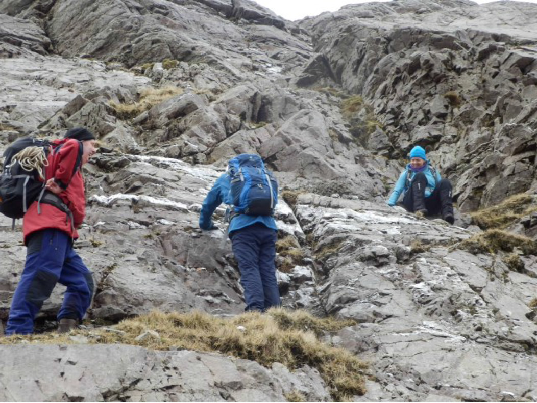
The scrambling was superb. It gave the knees a bit rest and the upper body a good work out: we pushed our bodies downwards through narrow channels, hauled ourselves around angular rocks and cautiously inched downwards in the vertical terrain. "Ye's did well," said Owen when we regrouped at the saddle point, seeming surprised – or was that disappointed? – that he hadn't had to use the rope to herd us to safety.
Luck was with us on the day in the form of the great weather and mostly clear skies which enhanced every moment and view. Once we reached the peaks and ridges, we could see north to the cloudcovered Mweelrea, which the Trekkers had climbed in 2011, east to the Maamturks, where we would hike the next day and west to the Galway Bay and Mayo islands. From the midpoint of the horseshoe, we looked across at Ben Bhan, at 729 meters the highest of the Bens, where we would hike on the final day.
In the late afternoon, tired legs climbed the final Ben of the day. Incongruously, this peak loses its "Ben" in English and is known as Derryclare (but Binn Doire Chláir, as Gaeilge). From its 673 meter summit our cars were visible as tiny inviting specs in the distance. A good 90 minutes later we had reached them, having crossed our first Wicklowlike feature of the day – a boggy marsh.
Our mini Maamturk Challenge
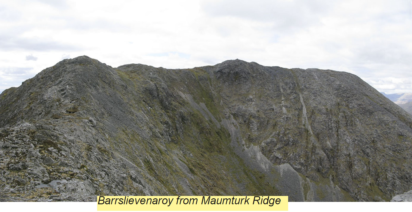
Day 2 came with none of the warnings we had received about the Glencoaghan Horseshoe. Nonetheless, it was another challenging day, taking us to the Central Maamturks and the peaks of Letterbreckaun, Knocknahillion and Maumeen, a distance of 12 km and 1,200 meters in elevation – though only half what those who were doing the Maamturk Challenge, which was taking place that day, would do. We met some of those doing the Challenge. Most had been on the go since 5.30 am that morning, when they started out near Maam Cross. Torrential rain greeted them as they set off, though they had well dried off by the time we met them around midday. Most – depending on their pace and fitness – aspired to reach Leenane, the finishing point, within 12 to 14 hours, though a few we met in the afternoon were pulling out because of injuries.
Our 8-hour day seemed tame by comparison, but it was another brilliant hike that took us by a beautiful waterfall, onto a ridge from where we could see the Maamturk Crossing hikers scrambling down a steep slope opposite and then climb towards the ridge on which we were perched. We had lunch by a lake and, in the afternoon, got a glimpse of a cloudfree Mweelrea. The last leg of the day's descent took us by a pilgrim site with a chapel and holy well dedicated to St. Patrick, where the stationsofthecross are still said from time-to-time.
Bagging the biggest Ben of all
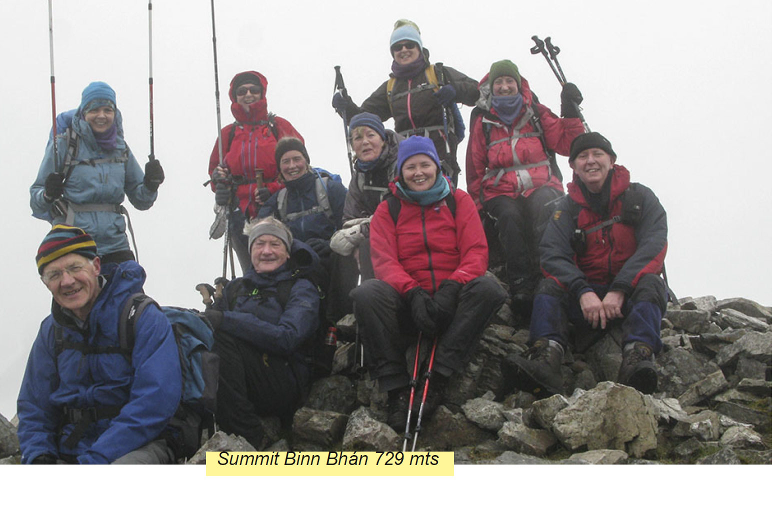
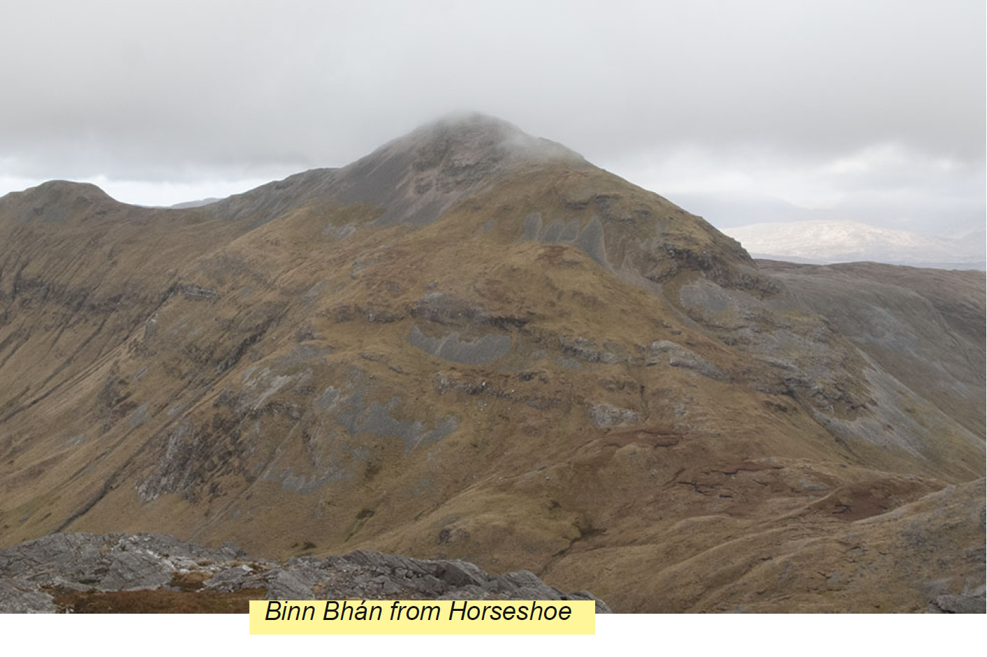 Day 3 took us back into Ben territory to bag the biggest Ben of all, Ben Bhán. All in all, we
covered 11 km and 1,000 meters. The good weather of the previous two days disappeared as
we rose in elevation and for the upper
part of the hike, we were in the clouds,
concentrating on the rocky, uneven
terrain. A fatherson
team we had
chatted with while having our banana
break said they were relieved to see
us and follow in our steps. They were
on a mission to reach the highest
points of every county in Ireland and
had tried for Ben Bhán on two
previous occasions but had been
pushed back by high winds and bad
weather. They weren't confident of
their navigation in cloudy weather, so
when we met them again on the summit, they were highly complimentary of Owen's navigation
and thankful they had had Trekkers footsteps in which to follow to the summit. The next weekend
they were heading to climb Carrauntoohil and, then, all going well, it would be mission
accomplished.
Day 3 took us back into Ben territory to bag the biggest Ben of all, Ben Bhán. All in all, we
covered 11 km and 1,000 meters. The good weather of the previous two days disappeared as
we rose in elevation and for the upper
part of the hike, we were in the clouds,
concentrating on the rocky, uneven
terrain. A fatherson
team we had
chatted with while having our banana
break said they were relieved to see
us and follow in our steps. They were
on a mission to reach the highest
points of every county in Ireland and
had tried for Ben Bhán on two
previous occasions but had been
pushed back by high winds and bad
weather. They weren't confident of
their navigation in cloudy weather, so
when we met them again on the summit, they were highly complimentary of Owen's navigation
and thankful they had had Trekkers footsteps in which to follow to the summit. The next weekend
they were heading to climb Carrauntoohil and, then, all going well, it would be mission
accomplished.
Halfway down the mountain, the sun emerged and we could see over towards the Glencoaghan Horseshoe, which we had traversed on day one. It was a lovely way to roundoff the weekend and appreciate the spectacular mountain and lake scenery that Connemara, in all its glory, has to offer.
Most Trekkers agreed it was the most challenging weekend's hiking they had done with the Trekkers, but it was highly rewarding. A huge thanks to Owen for all the work he did to make the trip a success: ensuring our accommodation was topnotch; impeccable leadership each day; and putting in multiple recces for each of the hikes – including one he did the day before the Glencoaghan Horseshoe, making it a fourday weekend for him. It certainly is one for the annals.
The doughty roll call for this endeavour comprised John Casey, Mary Dillon, Barbara Lane, Michael Lane, Gilbert Little, Gaye Maguire, Clíona McCarthy, Owen McKeown, Breda O'Hara, Ita Lawton. Brendan Bracken, Geraldine Boland.
Nicely illustrated book of Connemara Walks: Connemara & Mayo Walking Guide; Paul Phelan